

Geo-spatial Analysis of Tel Afar city
Population estimation, destroyed buildings, and land use classification
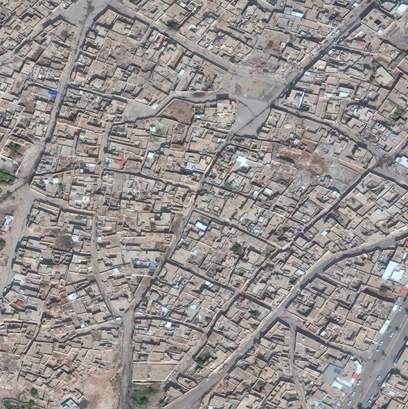
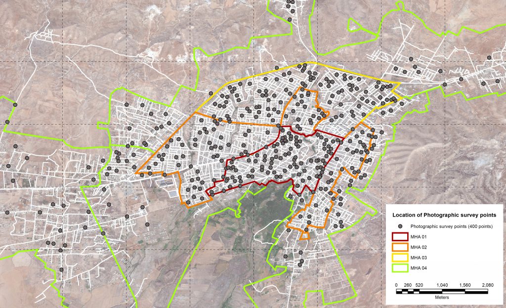
The objective of this project was to provide reliable empirical information on the built environment and on the distribution of population in the city of Tel Afar to inform humanitarian action and post-conflic recovery strategies. This entailed employing satellite imagery analysis, in-field photographic survey, and population modeling methods.
International Committee of the Red Cross (ICRC)
Context
In June 2014, the Islamic State Group (ISg) took control of Mosul city and surrounding areas, including Tel Afar city. In October 2016, the Iraqi Security Forces (ISF) and Kurdish Security Forces (KSF) held military operations to retake all territories under ISg in Ninawa Governorate. Heavy military operations were conducted among which a 12 days intensive offensive that led to the retake of Tel Afar city on 31st August 2017. This conflict (2014-2017 Iraq Civil War) resulted – in addition to the many human loss, complex displacement of population and general instability – to the fragilization or unavailability of access to essential services such as drinking water, food production, electricity, primary health care, wastewater removal and treatment.
As of 2020, the recovery of access to essential services is still continuing and the Water & Habitat Department of the ICRC in Iraq is currently focusing its assistance activities on the recovery of water services of Tel Afar City. Under this framework objective and empirical information on the built environment and the distribution of population are of fundamental importance to inform humanitarian action.
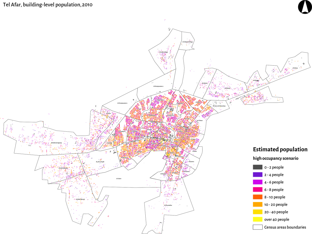
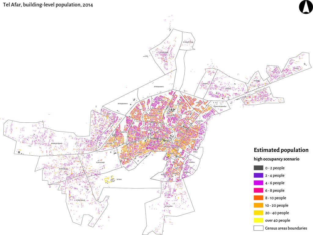
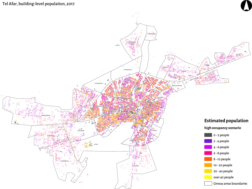
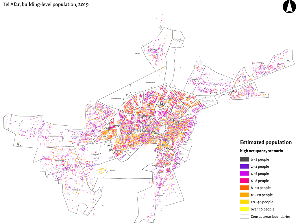
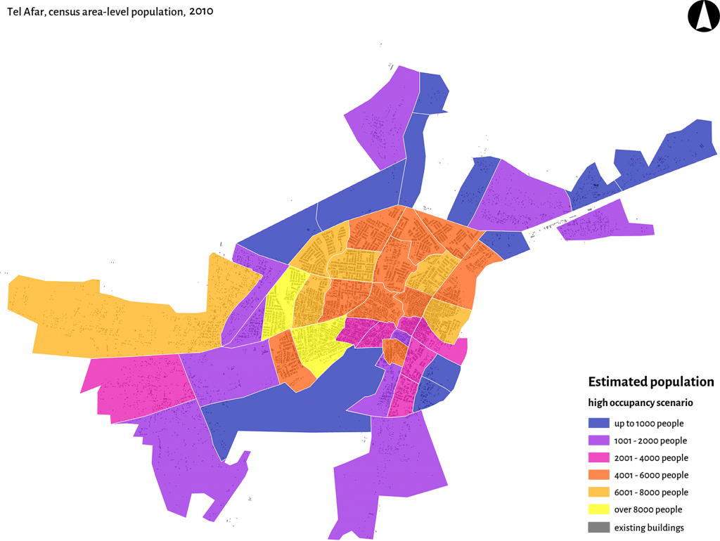
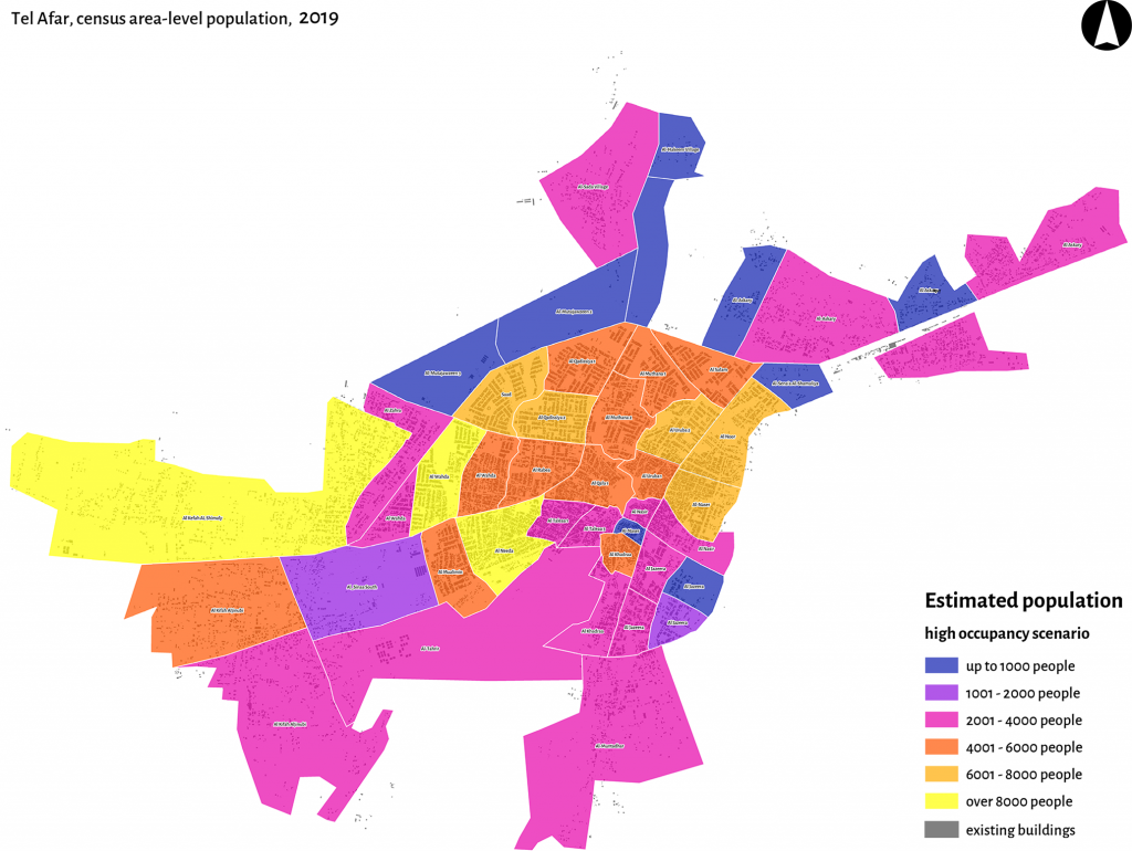
Employing satellite imagery analysis, in-field photographic survey, and population modeling, we provided objective and empirical information about population distribution, land-use, location of destroyed buildings, at four point in time – 2010, 2014, 2017 and 2019.
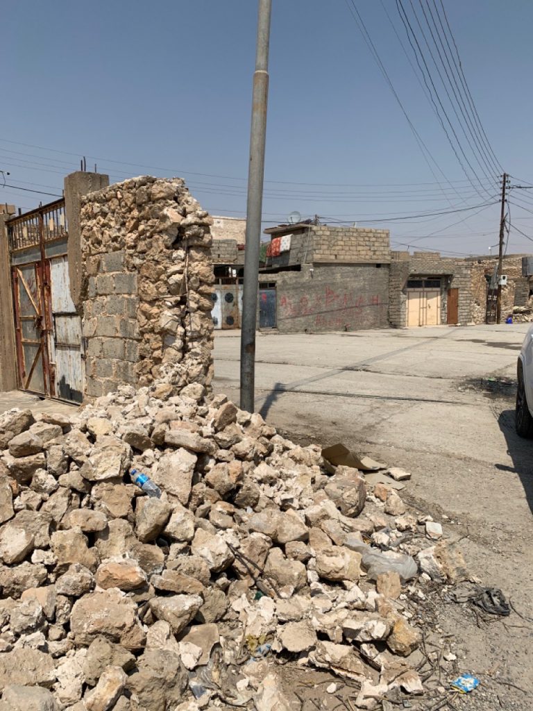
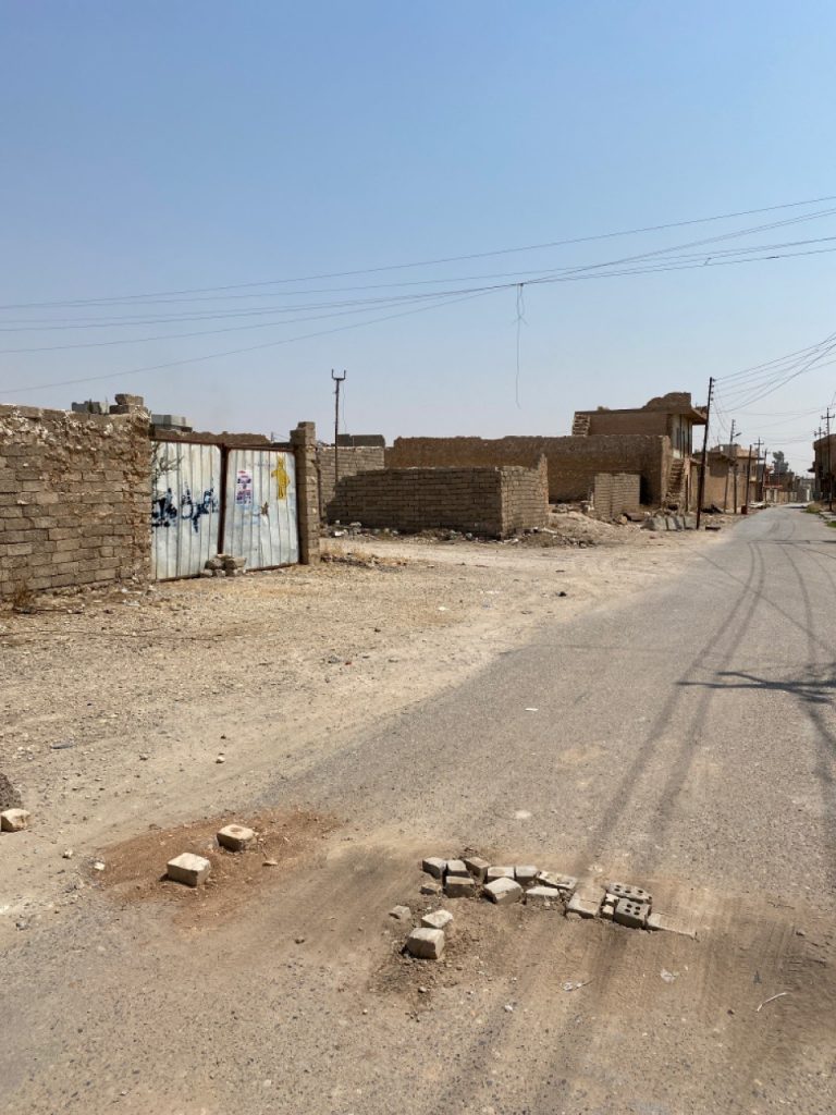
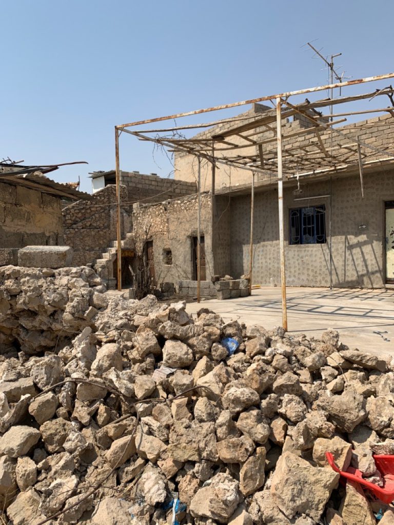
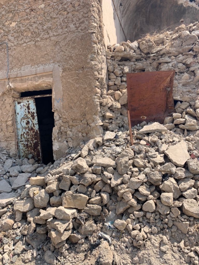
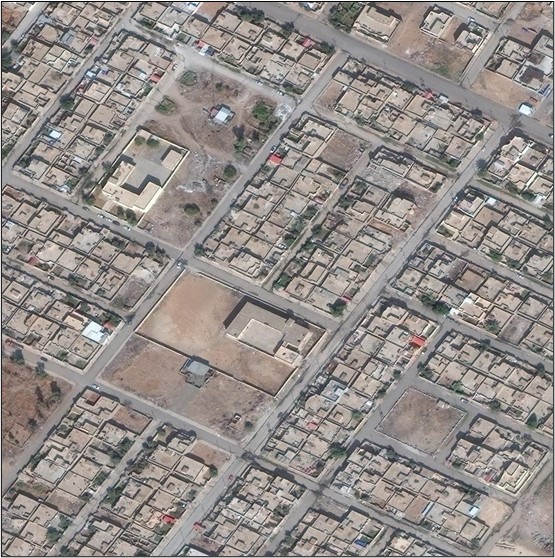
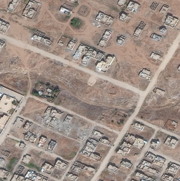
Few examples of the heavy damage and destruction caused to buildings and road infrastructure in Tel Afar by military raids during the 2014-2017 Iraqi civil war.
Our approach
Population, land use and destroyed buildings through the conflict
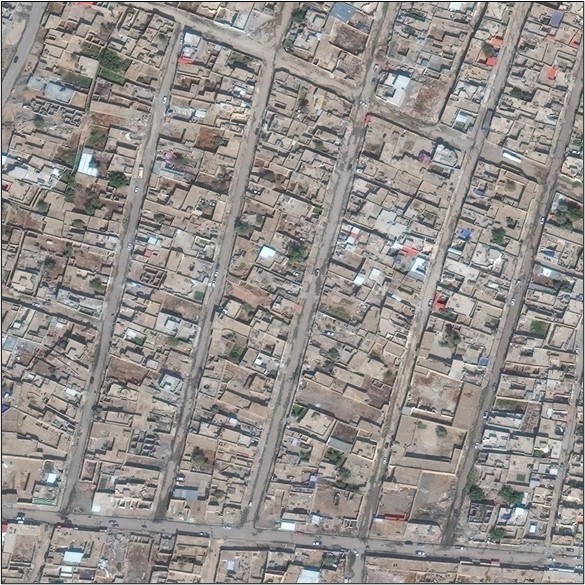
Our analysis showed that, from the beginning of the period of study (2010), up to the outbreak of the Iraq Civil War (2014), Tel-Afar city was a growing urban center, both in terms of overall urban footprint and in terms of new residential buildings, new public interest facilities, schools, health services and industrial facilities.
The outbreak of the 2014-2017 conflict bore a major impact on the city as a whole, both in direct terms, through loss of building infrastructure and of depopulation, and, more indirectly, by halting the process of development that was taking place in the years antecedent to the conflict.
Indeed, from our assessment, we were able to determine the number and predominant land use of buildings demolished during the period studied.
Based on our analysis, we were also able to preliminarily observe an asymmetry in the pattern of demolitions which suggests a selective raid strategy aimed at specific targets.
Two years after the conclusion of the Iraq Civil War, and despite the heavy losses sustained by the city, some encouraging signs of new urban growth are observed, albeit at a much slower pace than the 2010-2014 period.
As of 2019, population reaches almost pre-conflict levels and a re-start of construction activities is noticeable, particularly in peripheral areas of the city. This suggests a timid but ongoing process of recovery, both in terms of population capacity and urban footprint across all land-use categories.
Conclusions
Developing adequate responses for assisting people in urban areas that have been affected by armed conflicts couples the intrinsic complexity of urban settlements with post-war deprived conditions. The lack of objective and empirical data and more, the availability of partial and inaccurate data, prevent the development of any effective responsive strategy. Good spatial data are necessary for any urban intervention and in any context regardless the presence of conflict, deprivation or disasters. Accurate spatial data are even more necessary where resources are limited and local communities are difficult to reach and essential urban services have been damaged or totally destroyed during the conflict. Under this difficult framework, despite the humanitarian approaches to the emergency, what is the best way to gather accurate data without arming humanitaria operators anc civilians?
We demonstrated here that remote satellite imagery, once properly managed, can effectively provide the necessary basis to detect main urban features, such as building outline, population spatial distribution and location of the main land-use and infrastructure.
More projects of interest:
Advanced deep-learning for the estimation of spatial wealth through Copernicus Sentinel data and sparse in-situ survey data.
Urban Digital Twin model for the visualisation, navigation and exploration of multiple information layers on cities in space and time.
Mapping human behaviour before and after natural disasters using High-Frequency Location-Based data
A python library for the analysis of for High Frequency Mobility Data to support disaster response and infrastructural change
Mapping the relationship between urbanization and exposure to flood at a global scale between 1985 and 2015
An immersive A.I. Art experiment between poetry and photography for the Italian Pavilion at the XVII Venice Architecture Biennale.
| Cookie | Duration | Description |
|---|---|---|
| cookielawinfo-checbox-analytics | 11 months | This cookie is set by GDPR Cookie Consent plugin. The cookie is used to store the user consent for the cookies in the category "Analytics". |
| cookielawinfo-checbox-functional | 11 months | The cookie is set by GDPR cookie consent to record the user consent for the cookies in the category "Functional". |
| cookielawinfo-checbox-others | 11 months | This cookie is set by GDPR Cookie Consent plugin. The cookie is used to store the user consent for the cookies in the category "Other. |
| cookielawinfo-checkbox-necessary | 11 months | This cookie is set by GDPR Cookie Consent plugin. The cookies is used to store the user consent for the cookies in the category "Necessary". |
| cookielawinfo-checkbox-performance | 11 months | This cookie is set by GDPR Cookie Consent plugin. The cookie is used to store the user consent for the cookies in the category "Performance". |
| viewed_cookie_policy | 11 months | The cookie is set by the GDPR Cookie Consent plugin and is used to store whether or not user has consented to the use of cookies. It does not store any personal data. |