Community mapping through street-level photographic survey
Flood exposure and vulnerability mapping using street-level image automatic acquisition and machine learning
The World Bank
Context
Over the past few years, methods of acquisition of up-to-date street-level data through surveys have gained considerable momentum for a wide range of products and applications, including the three-dimensional mapping. These tools find multiple areas of application – from construction, renovation and integrity assessment of buildings to vulnerability and risk exposure mapping – with great potential in areas where this data is either scarce or hard to access.
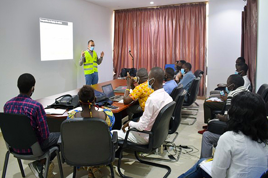
In this context, MindEarth was asked by the World Bank to preform a series of detailed street level surveys to collect detailed and reliable spatial information on three different cities: Brazzaville and Pointe Noire in the Republic of the Congo and Kinshasa in the Democratic Republic of the Congo. This has been run in collaboration with trained local partners and relying on surveying equipment provided by MindEarth. In Brazzaville, the survey inolved the neighbourhood of Moukoundzi and Soukissa, in Pointe Noire, the areas of Tchiniambi and Mboukou and in Kinshasa, the districts of Matete, N’Djili and Lemba.
In addition, MindEarth aimed at promoting a process of knowledge transfer by directly involving local communities of young mappers and spatial analysis into the process and, ultimately, help setting the basis for the establishment of economically sustainable Laboratories for generation and maintenance of spatial data.
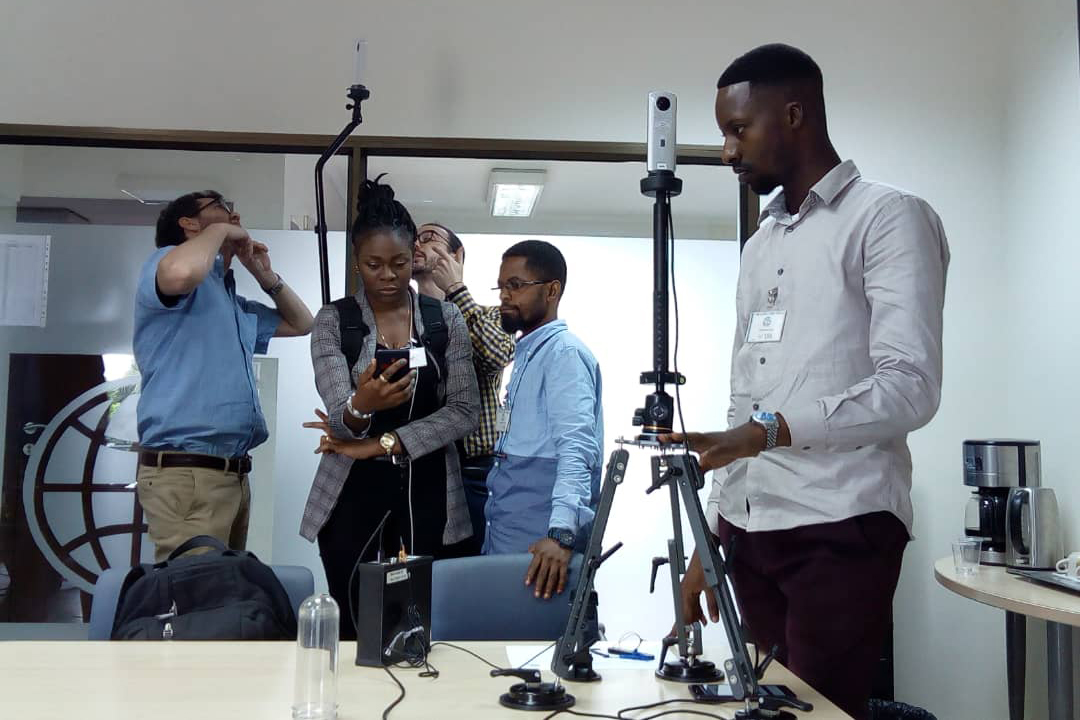
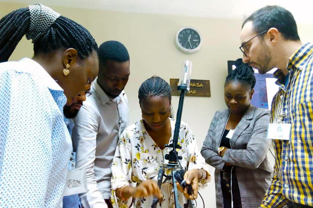
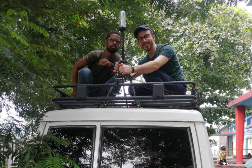
MindEarth’s survey kit mounted on a vehicle (top) and on a backpack (bottom) in Kinshasa
Street survey
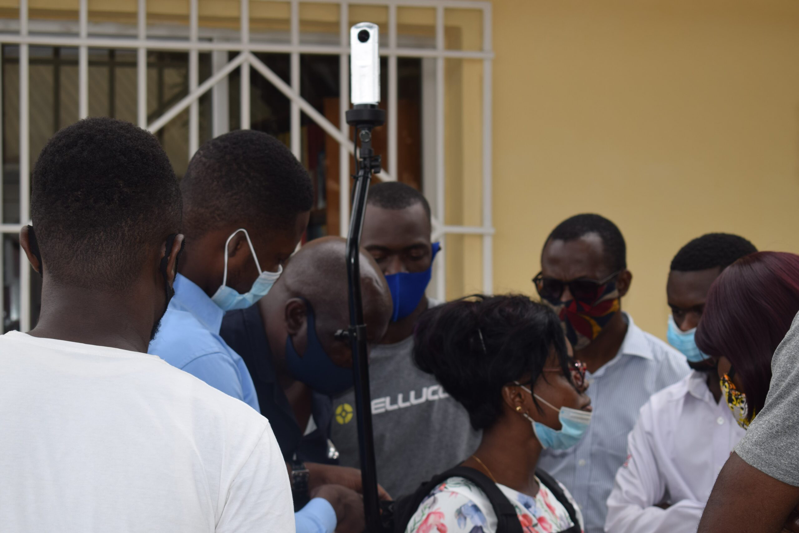
Accurately planning all phases of a street surveys is of key importance to then be able to extract required information: from survey planning to risk assessment, training and actual fieldwork. For each neighbourhood our target was to cover roads of all sizes, including main arterial roads, local and small access roads end collect information on materials and condition of the roads, location of drainage infrastructure, building height and land use, and location of street-based commercial activities. Local operators supported by the MindEarth team carried out surveys activities directly on the field relying on a survey kit puposefully designed by MindEarth.
This consisted of a custom 360 degree camera, a logging and power unit that hosts an embedded computer, a Global Navigation Satellite System (GNSS) receiver and batteries. The on-board software operates the camera, retrieves the images and stores them in its internal memory. This very robust system was developed by MindEarth to support extensive surveying lasting multiple days without the need to be connected to a power source for recharging or to any external data storage unit. The street-view survey kit is controlled by the operator via a common smartphone, which is included with the kit. This is connected to a Wi-Fi network created by the logging device. Thanks to this connection, the operator can access a web application running on the system that allows the full control of the acquisition.
In Kinshasa, survey activities took place between 5th ad 11th February 2020 and were performed by three survey teams: two of them moved by car, employing photgraphic survey kits mounted on a vehicle and one on foot, using a kit installed on a backpack. In Brazzaville and Pointe Noire the survey was conducted between 13th and 30th of September 2020. All three teams involved moved on foot, each using a backpack survey kit. The total length road network covered by survey teams was of around 65km in Brazzaville, 41km in Pointe Noire and 110km in Kinshasa.
Results
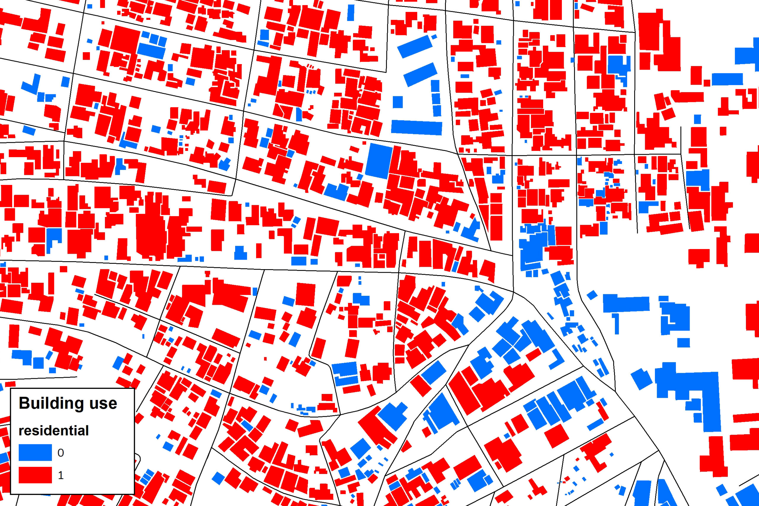
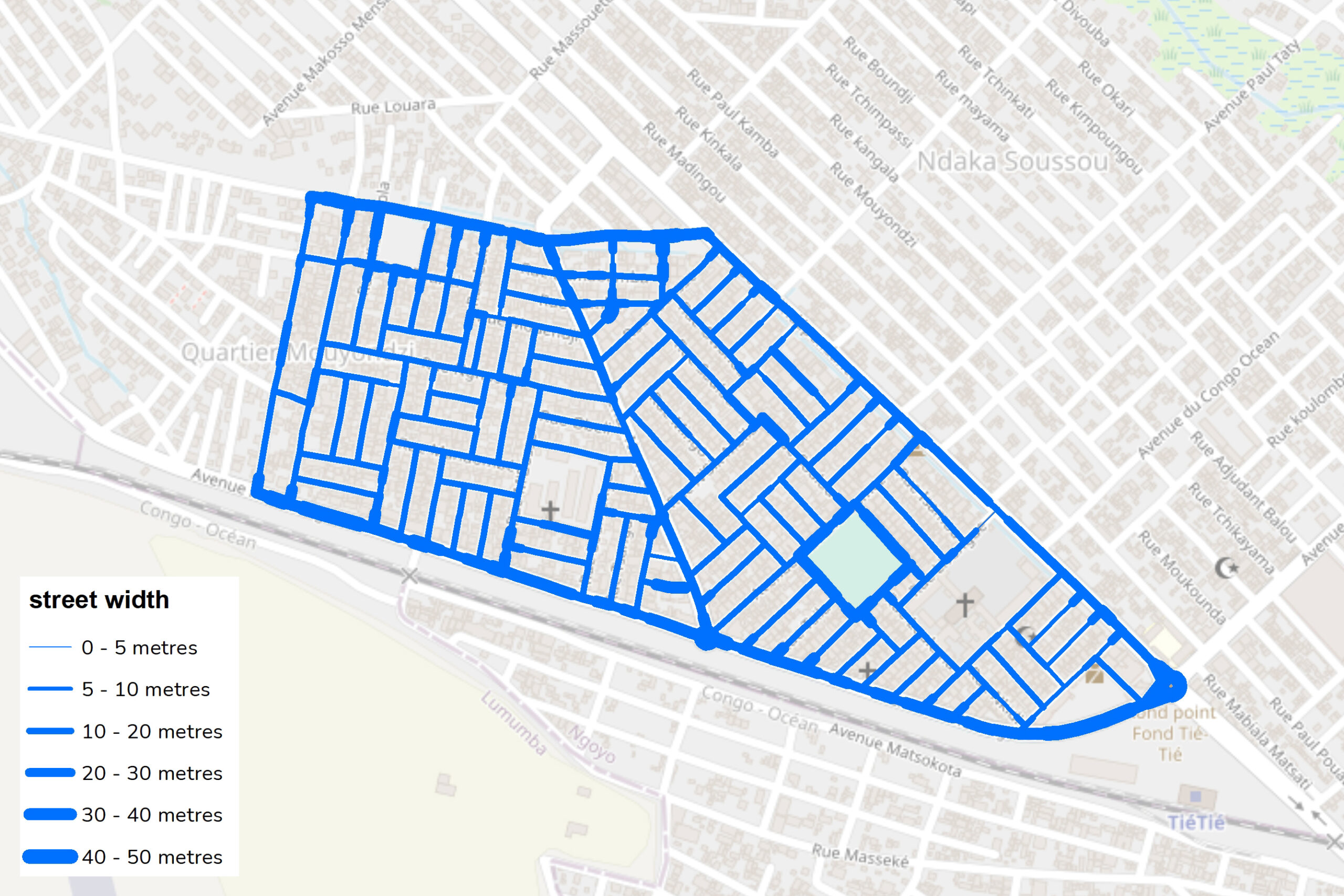
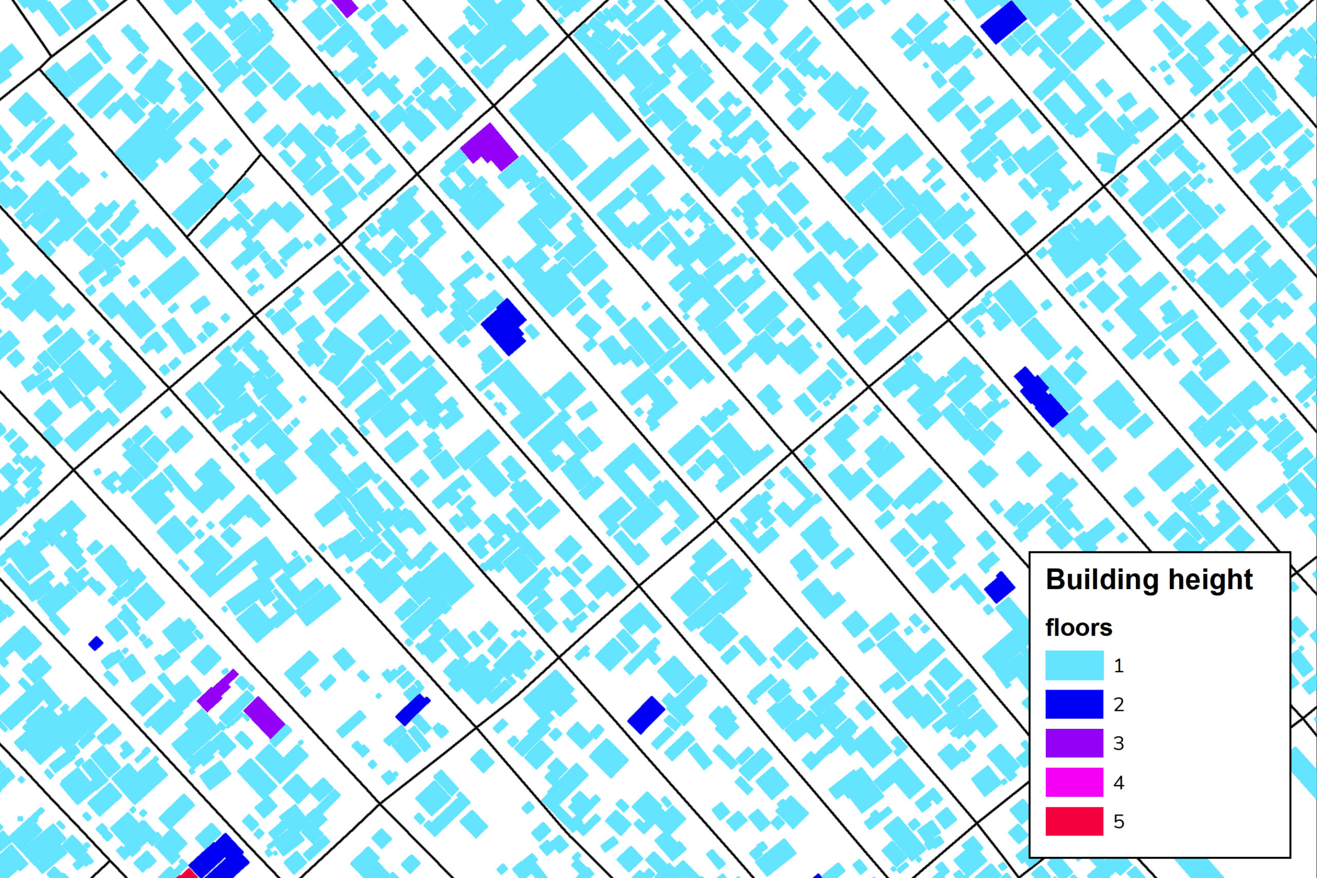
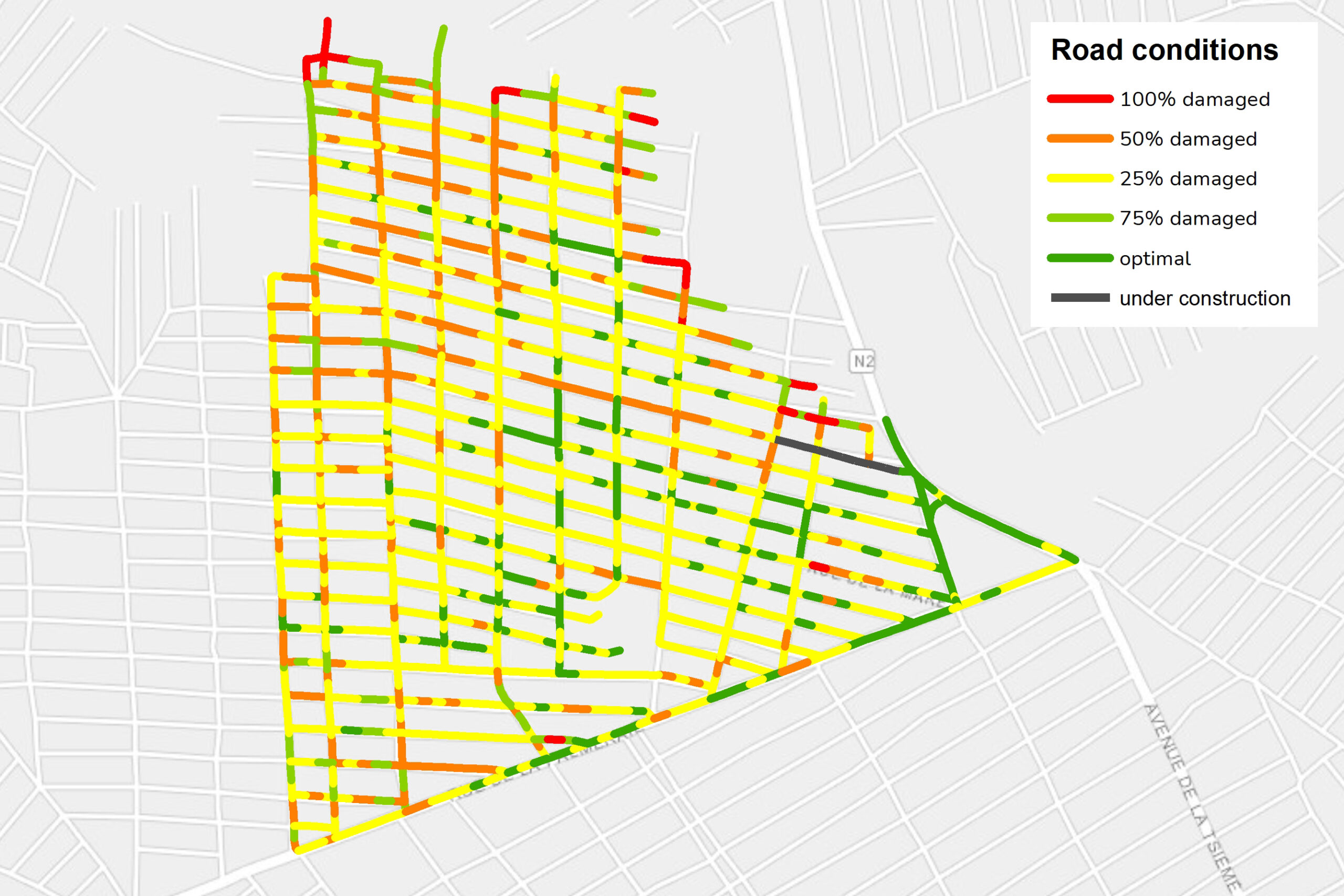
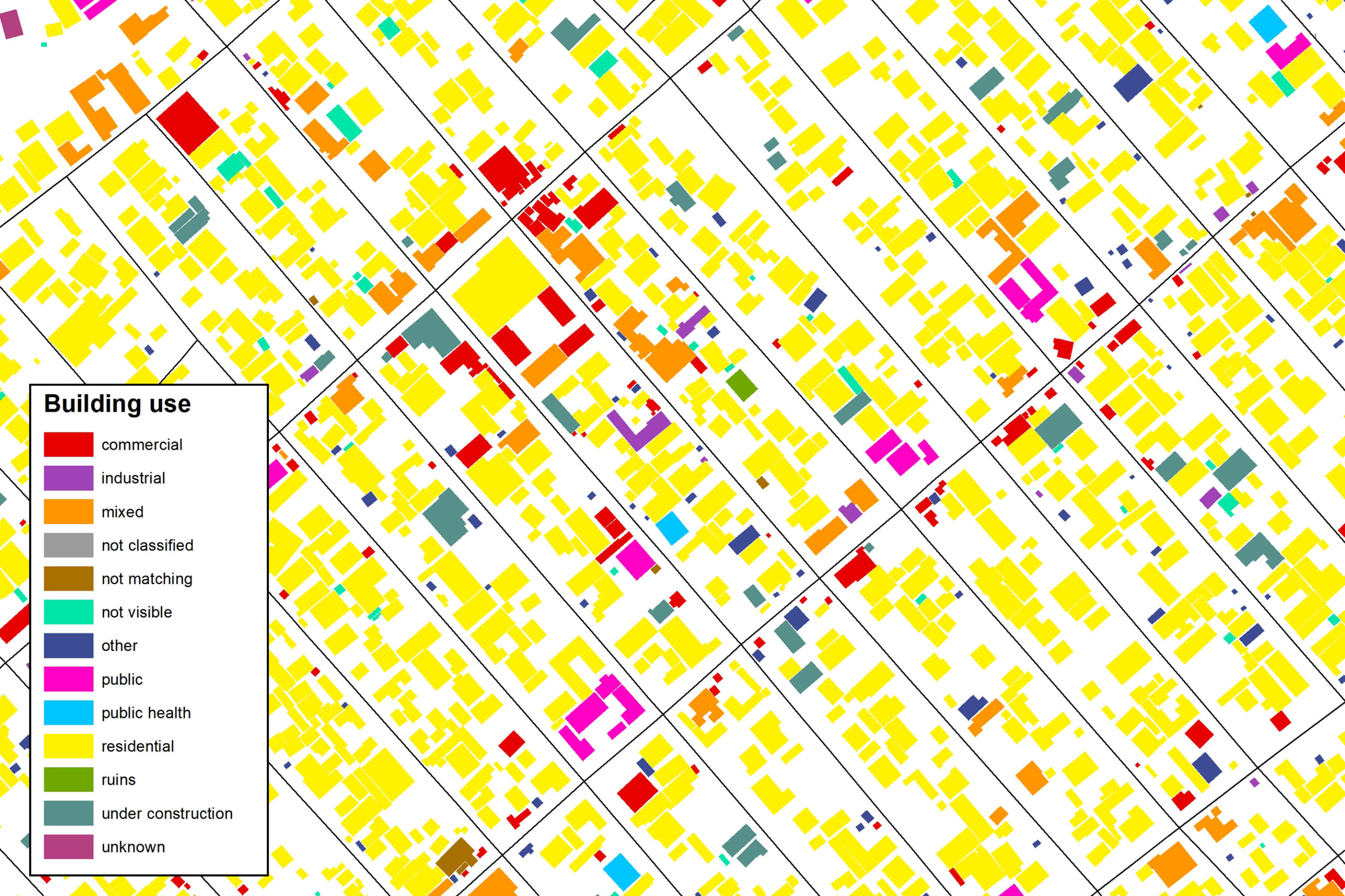
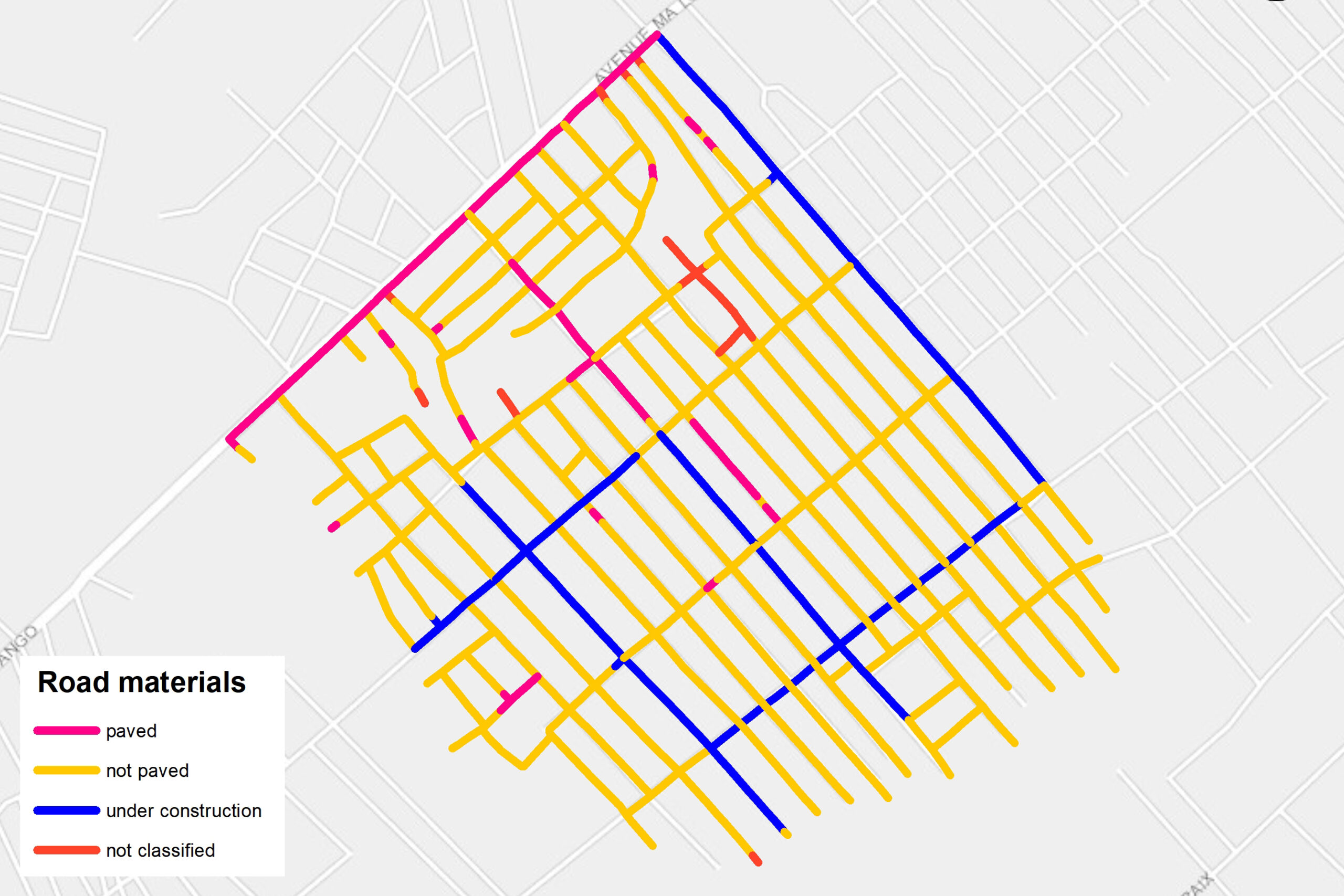
Survey data was elaborated via a mix of manual labelling and automated machine learning methods.This included information on condition of road infrastructure, including presence of flooded areas, sate of maintainance, presence of visible drainage systems, buildings height and land use class as well as location of street-commercial activities loacted on the road surface, such as market stands.
Finally, to ensure easy exploration of survey data, MindEarth developed an immersive online street-view visualisation platform where each collected photograph is geo-tagged to its actual location and overimposed to an OpenStreetMaps layer, so to aid navigation. On the platform, it is possible to move around the surveyed area, point and click on the map to enlarge any image collected and explore its surroundings by rotating view to the desired angle or zooming in and out in real-time.
Some excerpts of the extracted data in Brazzaville and Pointe Noire on buildings, streets and land uses.
The logo of the Brazzaville and Pointe Noire campaign: an elephant with the silhouette of key building.
Conclusions
The experiences in Kinshasa, Brazzaville and Pointe Noire demonstrated the many advantages of the implementation of these technologies on the ground, both from a technical and human perspective.
Tools as street-view and drone mapping are particularly promising in complex environments such as African cities to enable the generation of geo-referenced data that is sufficiently accurate, reliable and exhaustive to facilitate more-evidence based decisions, with potential applications ranging from environmental monitoring to risk mitigation and land use classification. At the same time, employing local people (i.e. students, young professionals) and involving local stakeholders and community groups, helped develop local skills in the areas of mapping, data extraction, GIS Science, with long-term benefits due to the built capacity.
Now, the challenge ahead is to retain gained skills and devise viable strategies so that such activities may be carried forward independently and in a sustainable way by local communities.
More projects of interest:
An immersive A.I. Art experiment between poetry and photography for the Italian Pavilion at the XVII Venice Architecture Biennale.
A python library for the analysis of for High Frequency Mobility Data to support disaster response and infrastructural change
Advanced deep-learning for the estimation of spatial wealth through Copernicus Sentinel data and sparse in-situ survey data.
Mapping the relationship between urbanization and exposure to flood at a global scale between 1985 and 2015
Urban Digital Twin model for the visualisation, navigation and exploration of multiple information layers on cities in space and time.
Population estimation, destroyed buildings, and land use classification
| Cookie | Duration | Description |
|---|---|---|
| cookielawinfo-checbox-analytics | 11 months | This cookie is set by GDPR Cookie Consent plugin. The cookie is used to store the user consent for the cookies in the category "Analytics". |
| cookielawinfo-checbox-functional | 11 months | The cookie is set by GDPR cookie consent to record the user consent for the cookies in the category "Functional". |
| cookielawinfo-checbox-others | 11 months | This cookie is set by GDPR Cookie Consent plugin. The cookie is used to store the user consent for the cookies in the category "Other. |
| cookielawinfo-checkbox-necessary | 11 months | This cookie is set by GDPR Cookie Consent plugin. The cookies is used to store the user consent for the cookies in the category "Necessary". |
| cookielawinfo-checkbox-performance | 11 months | This cookie is set by GDPR Cookie Consent plugin. The cookie is used to store the user consent for the cookies in the category "Performance". |
| viewed_cookie_policy | 11 months | The cookie is set by the GDPR Cookie Consent plugin and is used to store whether or not user has consented to the use of cookies. It does not store any personal data. |