Community mapping through street-level photographic survey
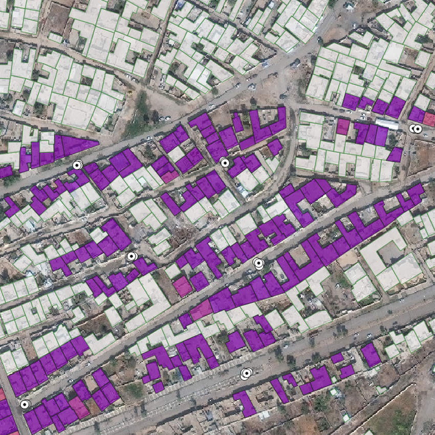
Flood exposure and vulnerability mapping using street level image automatic acquisition and machine learning

Flood exposure and vulnerability mapping using street level image automatic acquisition and machine learning
Population estimation, destroyed buildings, and land use classification