Global tracking of flood risk in urban areas
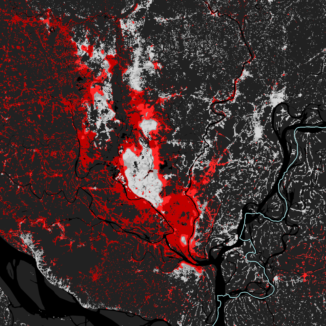
Mapping the relationship between urbanization and exposure to flood at a global scale between 1985 and 2015

Mapping the relationship between urbanization and exposure to flood at a global scale between 1985 and 2015

Urban Digital Twin model for the visualisation, navigation and exploration of multiple information layers on cities in space and time.